We are looking for contacts, local community groups, interested individuals, routes into funding, places to exhibit, support, volunteers, publicity and people to network with in order to develop our projects.
Please contact us by emailing milesanddacombe@virginmedia.com.

Showing posts with label power. Show all posts

Friday, 18 June 2010

Galleria delle Carte Geografiche


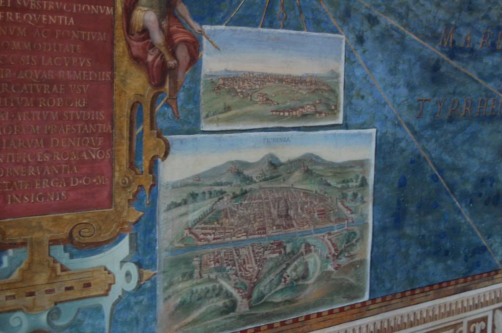
Thinking about maps in relation to power and politics reminds me of a visit to the Galleria delle Carte Geografiche in the Vatican otherwise know as the Hall of Maps. The gallery includes a series of frescoed maps of Italy and it's regions from drawings by the geographer Ignazio Danti . The maps were commissioned by Pope Julius XIII between 1580 and 1583, with later additions by Lukas Holste in 1631.
By commissioning the maps Pope Gregory XIII was attempting to revive the notion of Italy as a political unit at a time when it had devolved into many small states. The gallery of maps was inspired by descriptions of a great map of Italia said to have existed in the meeting hall at the temple of Tellus which was a meeting place for the Roman Senate on several occasions.
The frescos deliberately paired maps of "ancient Italy" with "new (modern) Italy" in an attempt to reinforce the papacy's claim to the inheritance of Roman imperial territory. The frescos are breathtaking in their scale and colour, as you walk through the hall, you are almost wrapped and surrounded by them, they are an exercise in power and control, they make connections and persuasively advocate the papacy's chosen viewpoint. It is quite some years since that visit and yet the impression made upon me remains vivid, the lands described have a visceral presence.

Thursday, 17 June 2010

Magnificent Maps... heralding change?

I've been reading the British Library's curator's blog for the Magnificent Maps exhibition.  There is a comment about maps not often heralding change, they usually reflect change (29 May 2010).  But I think they can have a very important role in changing our perceptions of things, in the selection of networks that the map maker chooses to make visible. The way we connect things in our minds (which maps make visible) can profoundly change the way we view them and then respond, or behave. They are so powerful. The whole idea of this exhibition is fascinating, the maps reflect but perhaps played a role in the changing relationships of power and politics over the centuries.

It is a bit like language.  The language we choose to use for things can profoundly change the way we view them.  By carefully selecting the language you use to describe something, you can subtley change the way people understand you.  So with maps and networks.  What you choose to link or show, the relationships your map chooses to reveal (or leave out!) will change the nature of how you view those elements, the importance you might give one over the other and so on.

Magnificent Maps:  Power, Propoganda and Art
"Maps can be works of art, propaganda pieces, expressions of local pride, and tools of indoctrination... Magnificent Maps brings together some of the most impressive wall maps ever created, many of which have never been exhibited before, and will demonstrate why maps are about far more than simply geography."