We are looking for contacts, local community groups, interested individuals, routes into funding, places to exhibit, support, volunteers, publicity and people to network with in order to develop our projects.
Please contact us by emailing milesanddacombe@virginmedia.com.

Showing posts with label rail. Show all posts

Saturday, 2 July 2011

Langwith Whaley Thorns


There was something very tranquil about Langwith Whaley Thorns station and we spent some time taking in the views from each platform and the bridge.


The livery was bright green and cream, and later we discovered that all the stations along this stretch use the same colours, railings and lamps. Although corporate, the colours seem clean and modern with a fresh feel. The railings and lamps were in keeping with the area, working with the flow of the landscape.


One of the things that struck us was the visual suggestion of rhythm in the line of lamps, the railings, the tracks, seeming to echo with the clickety clack of train wheels passing through the station.


We came to Langwith Whaley Thorns enticed by the name. It is named after a dense wood, recorded on the first Ordinance Survey Maps. "Whaley" is Celtic for water or spring and refers to the local springs and the near-by river Poulter and "Thorn" is an Anglo-Saxon word for wood. So the name may originally have meant either "Wood of the Springs", or "Wood above/between the water(s)". In the mid-nineteenth century, much of the wood was cut down, following the discovery of coal.


We felt it was important to make at least one train journey and hopped on for a brief trip to Whitwell and back. The route whisked us through fields interrupted by the now recognisable flash of the bright green railings at Cresswell station.


A small bridge at Whitwell takes you back over the tracks to the opposite platform. Strangely, the rail foot bridge is built separate to but right adjacent to a much older bridge over which passes the road, with views of houses and allotments.


View from the bridge at Whitwell.


Grazing lamp posts


After a brief look around Whitwell, we took the train back again. The conductor seemed quite amused by seeing us so soon between journeys and spent a few moments in conversation with us on our way back.


The driver flashed a beaming smile
before leaving us to make our way around the town of Langwith Whaley Thorns.


Whaley Thorns was a colliery town deeply affected by the pit closures in 1978, this has such powerful resonance with our starting point, Corby Station. By 1996 many properties in Whaley Thorns had become vacant and had fallen into disrepair, in 1998 the town was identified as a Renewal Area. 140 houses were demolished and replaced with owner occupied dwellings and housing rented through a Registered Social Landlord. Poulter View, a £4 million redevelopment of the former Bathurst Terrace site, is a mix of one, two, three and four bedroom houses. These include town houses, semi-detached and detached properties. The houses are close to a communal green space, play area and very near to Langwith Whaley Thorns Heritage Centre


Dreams and rust


and the salt of the earth


We picked up quite a lot of information from the helpful people at the Village Hall. Strange to think that the architecture of Frank Lloyd Wright influenced the planners and builders during Whaley Thorns boom time. Now it is a very quiet place, there are plans to raise money for a skate ramp and the Village Hall has had a splendid make-over with great spaces for gathering, exercise or meetings.


But the heart of the community lay within the community shop which was opened after a successful programme of table top sales at the museum. Snappabargain is located on Main Street Whaley Thorns and is open Monday, Tuesday, Wednesday and Thursday from 9.00 am till 3.00 pm. Also at the shop is the Snapbox Cafe where light refreshments are available to eat in or take away. We stopped in for a cup of tea and were amazed at the amount of community initiatives that Ian at the shop is involved in!


In the cafe we found out about a fantastic new project to involve local people in horticulture at The Rhubarb Farm, about some of the photography exhibitions and new groups being set up, the local historian Tony Warrener and his book about the area, the Heritage Centre and events that aim to link villages in the area.

Thanks to the people in the cafe we came away with a wonderful buzz from the positive inspiration of people like Ian and the Community Association. Regeneration is not just about buildings and bricks, but about people who invest their energy and creativity into getting people together and bringing life to a community. Once again, we found a town brimming with potential.

Monday, 18 April 2011

Snibston Lines and Connections

My third and final walk to Snibston started at the pink gates of Belvoirdale School near Coalville's town centre, and followed the route of the old railway line that used to transport coal from the mines.

Our walk took us along these lines, noticing the crossings of bridges and paths, and then climbing the hill through the country park.

Our first clue to where we were was the long straight path from the car park at the supermarket which goes towards town and then crosses over, eventually linking to the old rail track that Snibston still use for steam train rides.  The straightness of the path immediately made us wonder if it had been a rail line, when one of the children, Reuben, being sharp eyed, spotted the rail gate that is still at the end of the path, which confirmed our suspicions!

When I look at maps of Coalville, no matter what era the map is from I can always orientate where Snibston is by identifying the shape of the railway.  For me, the gentle curve of the rail line has become the signature of Snibston.

The shape of the walk from Belvoirdale with railway line
The walk took on the theme of lines:  we noticed the rail lines but also a ladder on a roof that seemed to lead nowhere.  We noticed cracks in glass panes or paintwork that suggested maps.  We found paths that connected to other paths, creating networks and straight lines.

Once at Snibston I showed the group how to make prints, and we all drew things that we had found on the walk.  Their drawings and prints were great!

My third map is inspired by this print by Liam, aged 7:

Liam made a print of the ladder we had seen that led nowhere.  He then repeated his print, and made another one for the corner shapes, so the print turned back on itself and joined up again.

Liam's print looks like a ladder.  But it could also be a railway line.  It could also be a map.  I love that it almost echoes the shape of our walk, returning back to the beginning, just as we walked back to where we started.

My final map will be about following lines and connecting back to the routes we discovered.

Saturday, 5 February 2011

Our Mystery Trip - where shall we go? It's up to YOU!

On 4th March Carole and Jo will be taking a Mystery Trip via rail to a station somewhere on the London Midland Network.  We don't know where we are going to go.  THAT'S UP TO YOU!

We are asking all readers of our blog to vote for where they would like us to go on the network.


You might know one of the places and think we should go, or you might just be intrigued by the name of the place and want us to find out what it's like there.

Please click here to look at the network map.  Choose a place and make your vote by leaving us a comment or emailing us at milesanddacombe@virginmedia.com saying where you would like us to go and why.

We will choose the best idea on Thursday 3rd March, the day before we go, and then we will write a report on the blog of what we found there!

Why are we doing this?  London Midland Network are doing a Great Escape ticket for only £10 for adults and £5 for children anywhere on their network between 19th February and 6th March 2011.  If you also go on a Great Escape, please write to us about your trip too and we will publish it on our blog.  Click here for more details on the Great Escape ticket.

Sunday, 28 November 2010

New commissions and a little Coalville history

Carole and I have both got ourselves new commissions!

I will be working on my Myth Maps project at Snibston Colliery in Coalville.  Carole will be working on a project for Leicestershire Museums, which she has called The Held in the Hand Hoard.  I'll let her tell you more about that herself.

I am particularly pleased with my Myth Maps project as it draws together a number of things I have been thinking about, things I have been blogging about here and it links with this project.

Leicester & Swannington rail ticket
A little history...

The colliery at Coalville, as I blogged before (see Preservation and Persistence), includes the wonderful historic railway track.  A line was put down by George and Robert Stephenson for the Leicester to Swannington Railway (L&S), one of the first of England's railways, opened in 1832 to bring coal from pits in west Leicestershire (Whitwick, Ibstock and Bagworth) to Leicester.

The Leicester & Swannington Rail Line
Whitwick Colliery, 1926
George Stephenson was known as the "father of railways", having built the first public railway using steam locomotion (the Stockton and Darlington Railway).  His son, Robert,  worked with his father and developed the famous "Rocket".  Robert was the engineer for the Swannington line and George opened the Snibston colliery the following year.

Midland Railway Station in Coalville, 1889
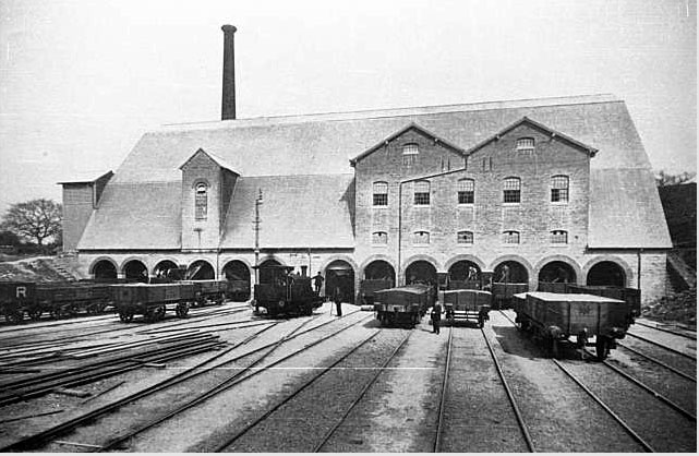
Sidings at Bardon Hill quarry
So the history of Snibston colliery and the railways are intertwined.  It was the success of the railways to speed up the transportation of coal that enabled the coal industry from west Leicestershire to thrive, which enabled the opening of the pit at Snibston.

Coalville East Station
Thanks to the Coalville Heritage Society website for these pictures.  Also, they have a wonderful sound archive of Coalville dialects, called Covill Tork - click on the link if you want to find out what the following mean (and make sure you have your speakers on!):

Woreeawreet?
Ayoopmissusenthemassteeratom?

Covill Tork 

Wednesday, 26 May 2010

A new journey

Welcome to the beginning of our new journey: Undiscovered Networks.

We have started this blog to open up our conversation as our new project develops.

Following our last project, which took place in Corby, Northamptonshire, UK, (please visit Fingerprints on the Pew to see our project book), we became interested in the new train station recently reopened. When a new rail network is re-opened, how does that connection affect a town? We started thinking about the idea of connections, networks, and undiscovered places.

We have selected 12 places that are linked to Corby on the network. 12 places we don’t know, 12 undiscovered places. Our project will find connections between these places.

Corby
Metheringham
Cleethorpes
Blythe Bridge
Peartree (Lincs)
Thetford
Dore
Haven House
Langwith-Whaley Thorns
Fiskerton
Whatstandwell
Wittlesea
March